In Bing Maps Bird's-eye view, is there a way to rotate the image other than by 90 degrees?

Wherever Bird's Eye View (BEV) is available, I've only found one way to rotate the image, which is by clicking on the curved arrows around the compass icon; and this means only the four cardinal directions are available for positioning the view.

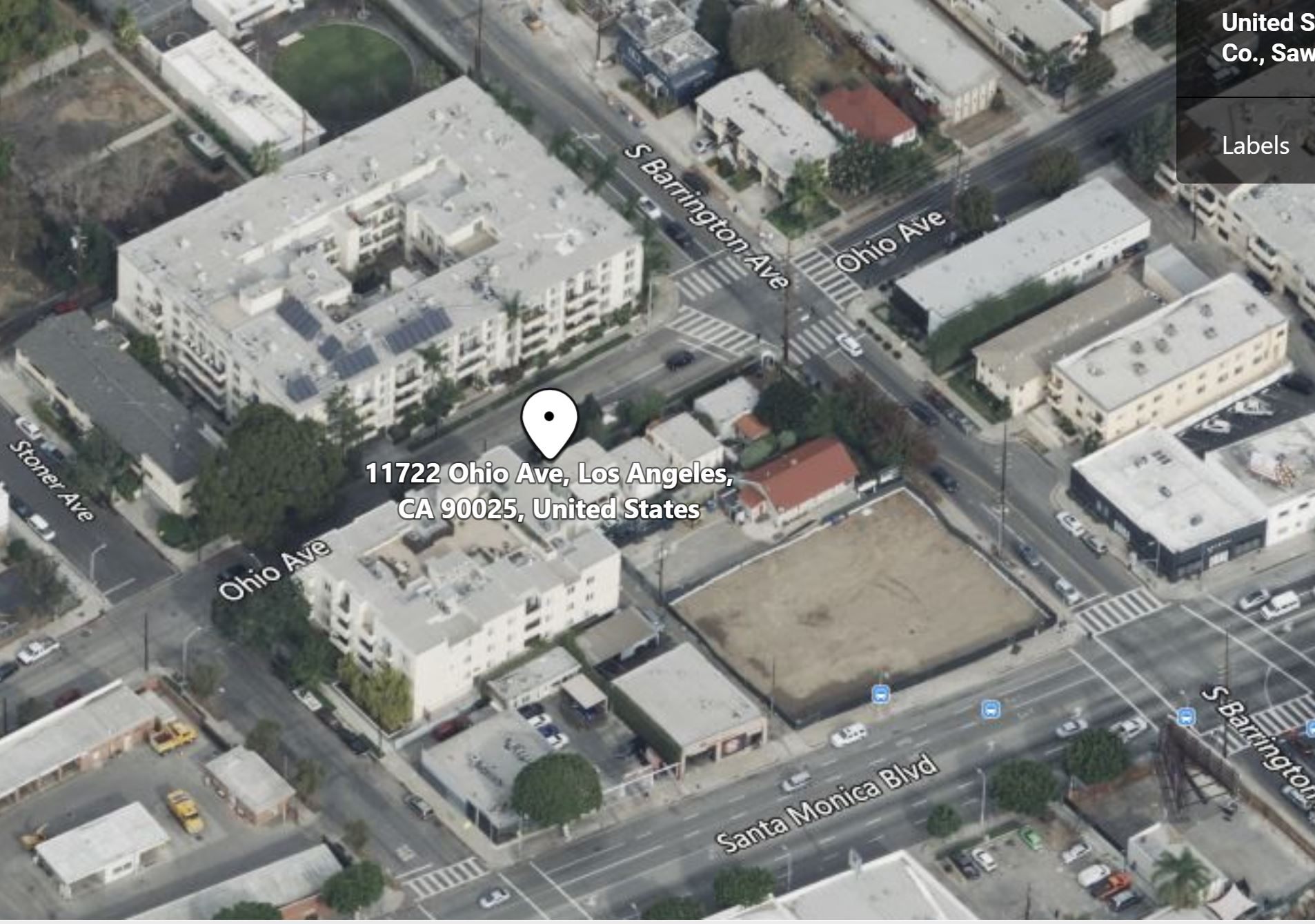
The problem with this is that cities, which have now apparently become the sole focus for BEV, are frequently laid out on the exact same lines, so you can't get an effect three-quarter angle view of streets and neighborhoods. Instead, you get only flat walls with flat appearing roofs directly above, looking much like a child's drawing, and this is despite the fact that it is still an accurate image. To illustrate, here are three examples from my hometown, Los Angeles. (All images are taken looking due north.)

From West L.A., where the grid is mostly tilted counterclockwise from true north. This is a great view, isn't it? I once lived in that large light-colored building at upper left.

Image

And here's one from Downtown, where the grid is skewed clockwise. This is another great view.

Image

And finally here's one from the Hancock Park neighborhood, where the streets run exactly east-west and north-south. This isn't so great. While it is accurate and contains all the same information, it's not really an effective view esthetically speaking. You don't look at this and say, "Wow!"

Image

Obviously, it would be ideal here if we turn the view by 45 degrees or 135 degrees, or by any arbitrary amount of arc, but I'm not seeing any option to do that. Is it there somewhere and I'm just not seeing it, or does it not exist at all? And if it doesn't exist, has Microsoft considered adding it?

Hello, Pithecanthropus. Thanks for reaching the Microsoft Community. My name is Lucas and I'm a Microsoft user just like you. I'll be happy to assist you today.

I'm pretty sure the only option to rotate the image when using bird's eye on Bing maps is by clicking on the two rotating arrows that rotate the image 90º.

If you want to send a feedback about this feature on Bing Maps, click the Feedback link on the bottom of most Bing Maps webpages. All feedback is reviewed, but you may not receive a personal response regarding your feedback.

Feel free to ask back any questions.
Give back to the Community. Help the next person who has this issue by indicating if this reply solved your problem. Click Yes or No below.

1 person found this reply helpful

·

Was this reply helpful?

Sorry this didn't help.

Great! Thanks for your feedback.

How satisfied are you with this reply?

Thanks for your feedback, it helps us improve the site.

How satisfied are you with this reply?

Thanks for your feedback.

Hi Folks,

BirdsEye is collected by flying a North-South and East-West grid over a city so only these directions are available by design. If you want to know more, Vexcel Imaging is the partner that provides us the images so you can look on their web page for more details.

Sincerely,

IoTGirl

Without ME it's just "AWESO" - Barney Stinson

2 people found this reply helpful

·

Was this reply helpful?

Sorry this didn't help.

Great! Thanks for your feedback.

How satisfied are you with this reply?

Thanks for your feedback, it helps us improve the site.

How satisfied are you with this reply?

Thanks for your feedback.


Question Info


Last updated April 12, 2025 Views 3,273 Applies to: